
General Information
AREA
Nearly 2400 sq. miles or 6000 sq. km.
FOREST LIMITS
North-Bagerhat, Khulna and Sathkira districts : South-Bay of Bengal; East-Baleswar (or Haringhata) river, Perojpur, Barisal district, and West-Raimangal and Hariabhanga rivers which partially form Bangladesh boundary with West Bengal in India.
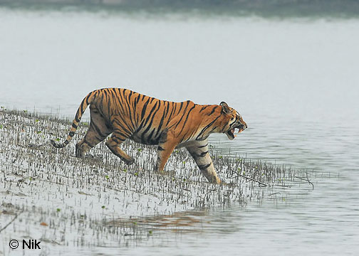
MAIN ATTRACTIONS
Wildlife photography including photography of the famous Royal Bengal Tiger, wildlife viewing, boating inside the forest will call recordings, nature study, meeting fishermen, wood-cutters and honey-collectors, peace and tranquility in the wilderness, seeing the world's largest mangrove forest and the riverine beauty.
FAMOUS SPOTS
Hiron Point (Nilkamal) for tiger, deer, monkey, crocodiles, birds and natural beauty.
Katka for deer, tiger, crocodiles, varieties of birds and monkey, morning and evening symphony of wild fowls. Vast expanse of grassy meadows running from Katka to Kachikhali (Tiger Point) provide opportunities for wild tracking.
Tin Kona Island for tiger and deer.
Dublar Char (Island) for fishermen. It is a beautiful island where herds of spotted deer are often seen to graze.

No comments:
Post a Comment